
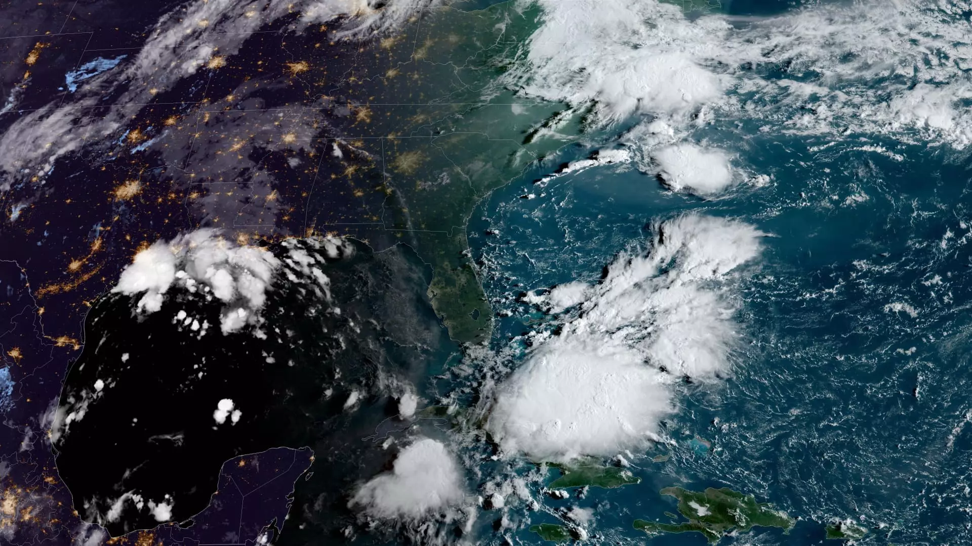
An ominous disturbance brewing in the Gulf of Mexico is predicted to intensify into a tropical storm by Monday, with the potential to escalate into a hurricane before making landfall along the U.S. Gulf Coast later in the week. Known as Potential Tropical Cyclone Six, this weather system is currently situated approximately 300 miles south-southeast of the mouth of the Rio Grande, moving in a north-northwest direction. The National Hurricane Center has issued early advisories indicating that the storm is likely to traverse offshore of the northern Gulf of Mexico by Tuesday and approach the coastlines of Louisiana and upper Texas by Wednesday.
Tropical storm watches have been put in place for northeastern Mexico and southern Texas as a precautionary measure. Potential Tropical Cyclone Six is anticipated to unleash heavy rainfall, potentially leading to flash flooding across regions in northeast Mexico, southern Texas, southern Louisiana, and southern Mississippi until Thursday morning. While the exact trajectory of the storm remains uncertain, there is a mounting concern regarding the possibility of life-threatening storm surge and destructive winds, particularly along portions of the Louisiana and Upper Texas coastlines starting from Tuesday night onwards.
The ongoing Atlantic storm season in 2024 commenced in June and is set to conclude on November 30th. So far, there have been five named storms in the region, out of which three progressed into hurricanes. The hurricane center reported that the tropical cyclone activity in August was marginally below the average, with Debby making landfall in Florida as a Category 1 hurricane before regaining strength and hitting South Carolina as a tropical storm. Additionally, Ernesto intensified to a Category 1 hurricane while passing over Bermuda in mid-August.
Prior to the commencement of the Atlantic storm season, the National Oceanic and Atmospheric Administration (NOAA) had indicated a likelihood of above-normal hurricane activity in the basin for the year. The forecast projected a range of 17 to 25 total named storms, characterized by wind speeds of 39 mph or higher, out of which eight to 13 were expected to escalate into hurricanes. This elevated forecast was attributed to the near-record warm temperatures in the Atlantic Ocean, La Niña conditions prevailing in the Pacific region, reduced trade winds in the Atlantic, and minimal wind shear factors.
The looming threat posed by Potential Tropical Cyclone Six serves as a stark reminder of the unpredictable nature of weather patterns and the importance of preparedness in the face of natural disasters. It is crucial for residents in the potentially affected areas to stay vigilant, heed official warnings, and take necessary precautions to ensure safety and minimize potential damage.
Leave a Reply